“It is good to have an end to journey toward; but it is the journey that matters, in the end” ~ Ursula K. LeGuin
I woke before dawn on Trip Day…to rain drops hitting the window. No matter, rain or shine, it was time for the cross-Florida adventure to begin! Daylight revealed an overcast drizzly January morning…but here in South Florida that means temps in the 60’s, expected to reach the 70’s later in the day. The journey began with a 1.5 hour drive north to Sandsprit Park in Stuart, FL, just inside St. Lucie inlet on the Atlantic coast. The preparations were done…it was time to launch and let the fun begin!
Despite the grey skies, spirits were high, and the scenery was completely new and interesting. As we headed west, we observed large waterfront mansions, boats of all sizes from kayaks to 100’ yachts, and carefully manicured real estate along the St. Lucie River. As the salt water made the transition to brackish, the scenery also changed. The coastal high rises gave way to smaller, more modest homes with more acreage, campgrounds, and expanses of undeveloped waterfront. The offshore-style fishing boats changed to bass boats and Carolina skiffs. As we passed beneath highway overpasses heading west, the pace of life took on a more mellow, countryside feel. We reached the first lock about 15 miles into the journey. The St. Lucie lock was the largest lock, and also the single largest change in water elevation we would experience on the whole trip…a 15’ rise! The whole process took a mere 10 minutes, and according to the lock operator, used 1.5 million gallons of water to raise us that 15 feet!!
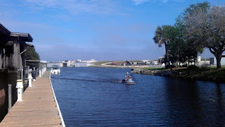
The journey took on a whole different feel on the other side of that lock. We were now in 100% fresh water, and we were greeted with miles of wake zone free waterway. The going was easy and smooth, and we often went great distances without encountering any other boats. The first stop was at the Indiantown marina, approximately 35 miles in, and 10 miles from Lake Okeechobee. The people were incredibly friendly, the service was excellent, and it turned out to be a great place to take a break and walk around the tranquil, sailboat-filled marina. After a fuel topoff, we continued west to Port Mayaca Lock, on the eastern shore of Lake Okeechobee. We were the only boat at the lock, and found an interesting pull cord along the wall near the lock to notify the lock attendant of our presence. After a small 1’ rise, we were released into the vastness of Lake Okeechobee.
Due to the overcast skies and rain, the visibility on the lake wasn’t great…maybe a few miles. Soon after setting across the lake, we were unable to see land in any direction. Thanks to some thorough pre-trip prep, I had the coordinates stored in waypoints in my GPS to guide us across the misty lake safely. The crossing was 25 miles from Port Mayaca to the lock at Clewiston. We did run across a bizarre and mysterious giant concrete structure out in the middle of the lake. I have been unable to find any information on it anywhere since returning…so we will chalk it up to being part of the strange magic of an epic water trip!
 |
| Bizarre concrete lake structure. |
 |
| Dockside accomodations in Clewiston. |
Another 10 miles brought us to the Ft. Myers City Marina, right in downtown. Friendly staff helped me refuel, and provided free dockage in order for us to walk into town to have lunch with some friends who live there. After a refreshing bowl of nachos and a margarita, we were poised to finish the final leg of our journey. We set off into a lowering sun on the western horizon towards Sanibel Island. Back in salt water and with the distant Sanibel Causeway Bridge now in sight, the realization that the trip was nearing completion put me in a rather contented but reluctant frame of mind…I was enjoying the trip, and didn’t want it to end…but it is rewarding to accomplish your goals, so it was reflective and satisfying. A magnificent sunset lit our path the last 10 miles or so. We arrived at the public boat ramp just after sunset that evening. My amazingly generous and supportive friends arrived shortly afterwards with my truck and trailer, and we all drove into town to enjoy celebratory cocktails at Doc Ford’s Rum Bar on Sanibel before setting off on the long drive back to Miami. Another successful trip under my belt, and all I can think of is…what will the next adventure be?!
 |
| Sunset over San Carlos Bay, near Sanibel Island. |
 |
| Celebration was in order! |


VERY enjoyable read! Kristy.....you have a future as a travel writer.
ReplyDelete